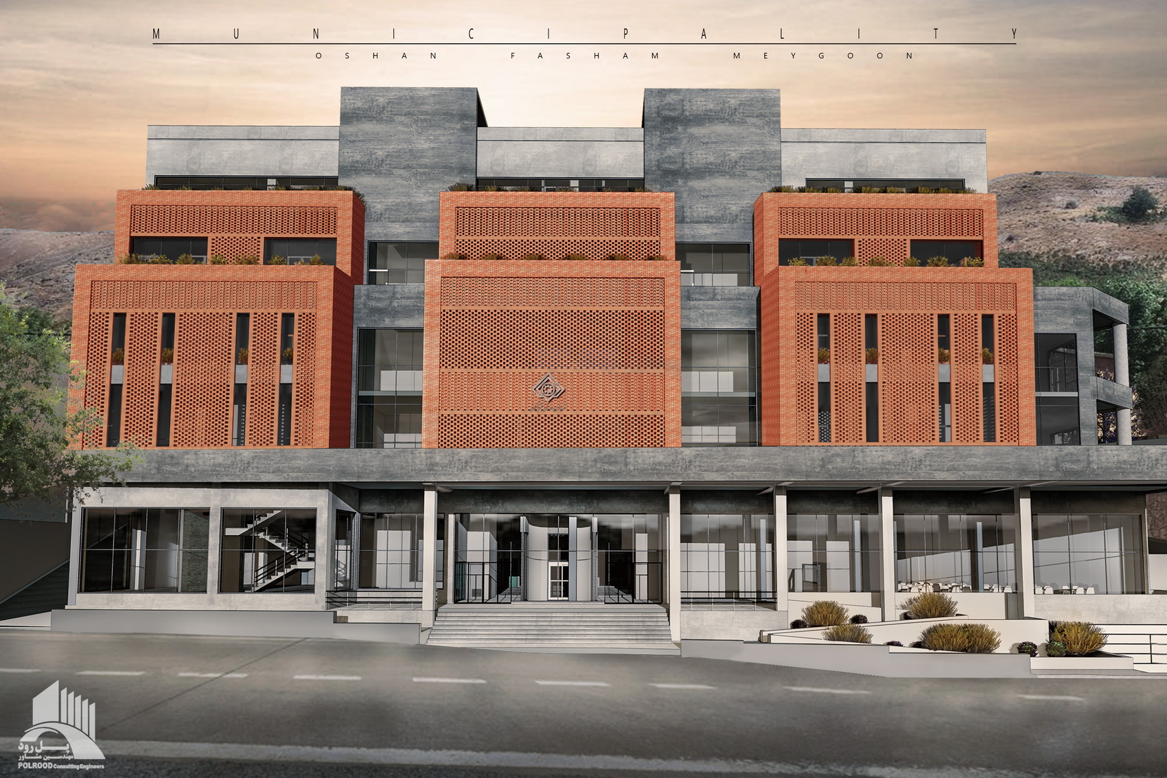
ساختمان شهرداری اوشان، فشم و میگون
می 26, 2020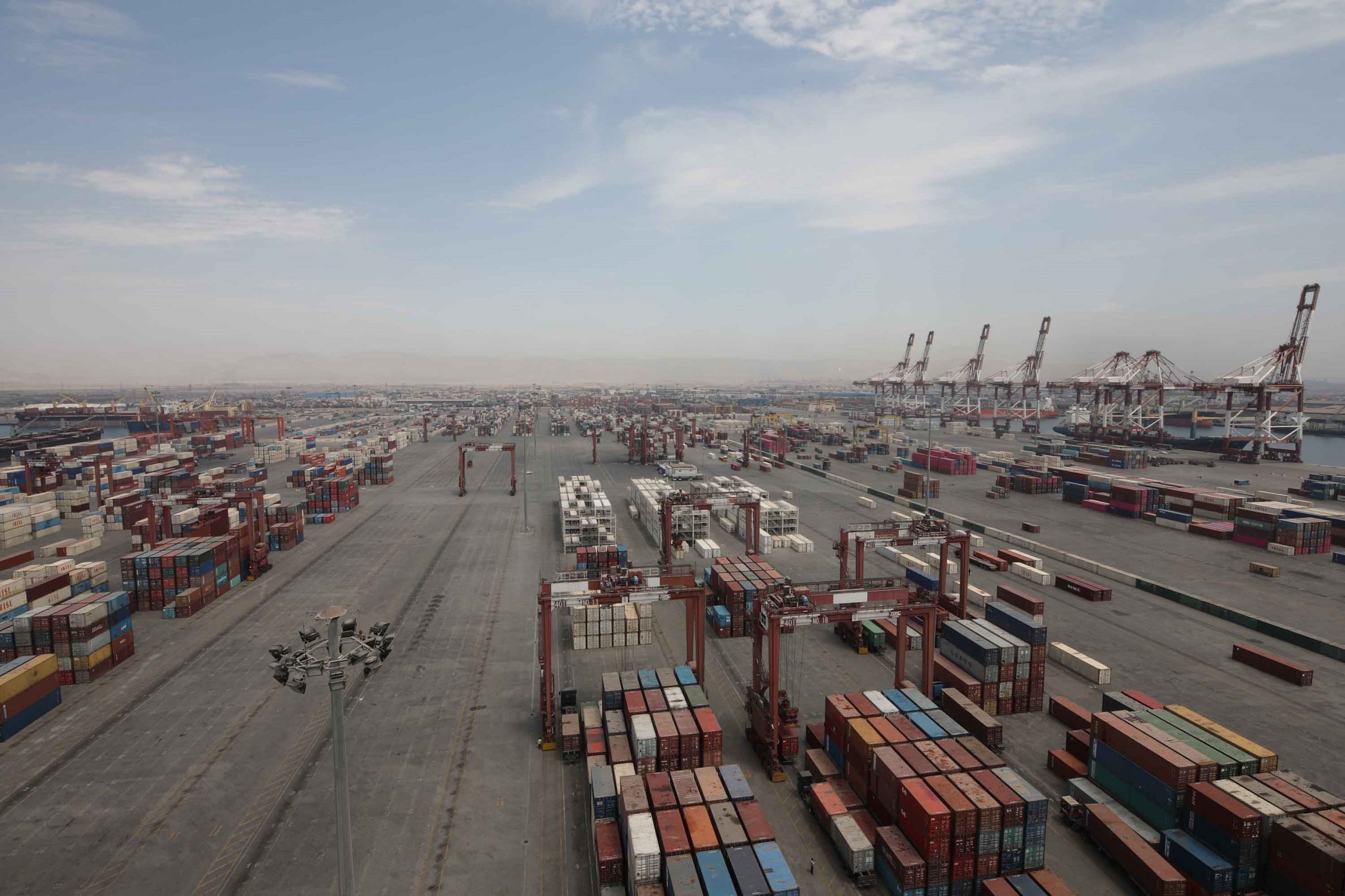
مطالعات طرح جامع بندر تجاری جنوب کشور
دسامبر 18, 2021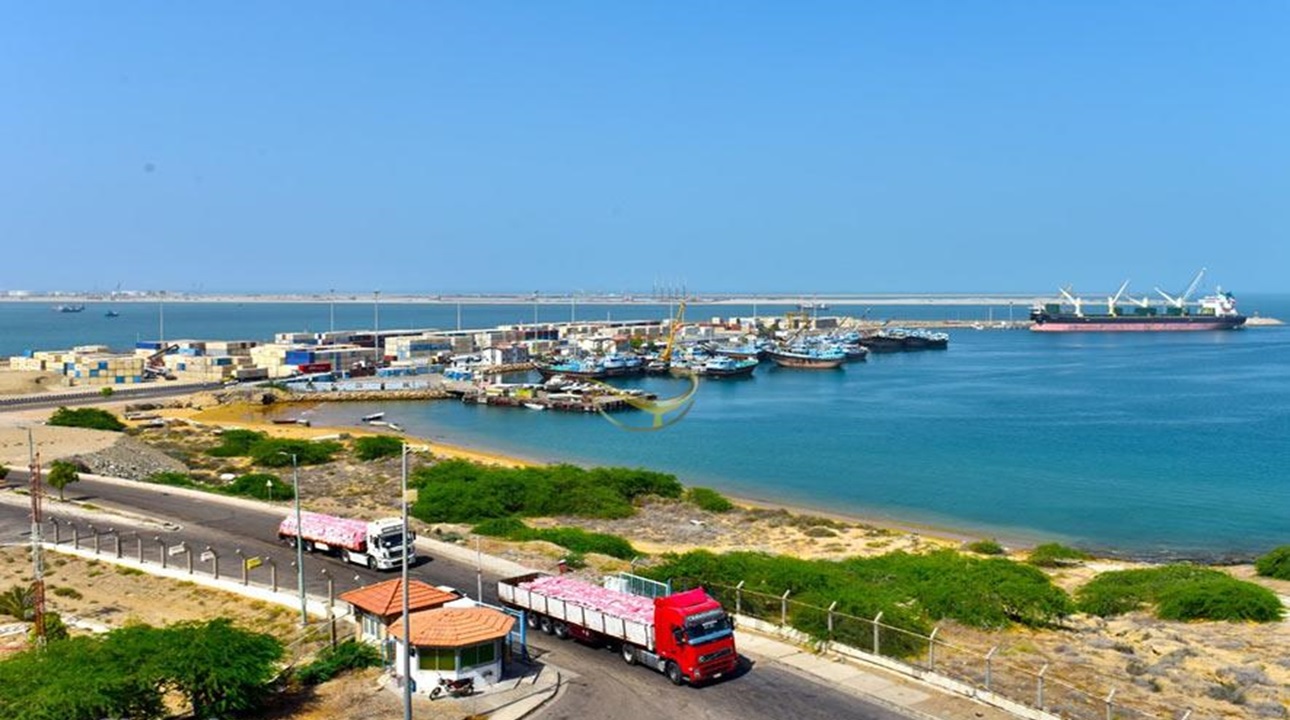
شرکت پلرود
مطالعات حملونقل و ترافیک جنوب منطقه آزاد و شهر چابهار
مطالعات حملونقل و ترافیک محدوده تبادلی و اتصالی جنوب منطقه آزاد و شهر چابهار با الگوی یکپارچگی خدماتی و دسترسی
کارفرما: شرکت توسعه و عمران آرمان مکران
مشاور: شرکت مهندسین مشاور پلرود
سال 1400
با توجه به پیش بینی تقاضای ترافیک قابل توجه در محدوده اراضی 200 هکتاری مقابل بندر شهید کلانتری و در محدوده اتصال شهر چابهار و اراضی 14 هزار هکتاری منطقه آزاد و بر اساس توافق صورت گرفته با سازمان منطقه آزاد چابهار، مطالعات ترافیکی یکپارچه برای کل محدوده سایت (مجاور بزرگراه شهید کلانتری، کمربندی شمالی، تقاطع مقابل بندر شهید کلانتری و محدوده انبارها و کلیه مسیرهای دسترسی مربوط به این محدوده) صورت گرفته و بر این اساس، مسیرهای اختصاصی ورود و خروج کالا و کامیون بین بندر شهید کلانتری و سایت مورد مطالعه پیشبینی و ترجیحأ مسیر تردد کالا و کامیون به بندر مزبور نیز از طریق همین مسیر انجام گردیده است. براساس این ضرورت، مطالعات ترافیکی در چهار فاز انجام شده است. گزارش اول به آشنایی با طرح و گزارش دوم به شناخت وضع موجود و جمعآوری اطلاعات پرداخته است. در این گزارش در ابتدا اطلاعات مرتبط با الگوی انجام سفر جمعآوری گردیده و مراکز عمده مولد و جاذب سفر مشخص شده است. سپس شبکه معابر موجود در محدوده مورد مطالعه مانند جهات حرکتی، سلسله مراتب عملکردی و اطلاعات هندسی و فیزیکی شبکه موجود بررسی شده است. در نهایت نیز اطلاعات مربوط به پارکینگ، حملونقل همگانی و تردد عابرپیاده گردآوری گردیده است. گزارش سوم به تحلیل شبکه و مدل سازی پرداخته است. در این گزارش در ابتدا به بررسی و معرفی طرح پیشنهادی و سپس به بررسی و پیش بینی ترافیک معابر پیشنهادی بر اساس کاربری مجموعه (برآورد تولید و جذب سفر) مانند فرودگاه، زمینهای 47 هکتاری، 14 و 18 هکتاری، زمینهای لجستیک و بیمارستان پرداخته شده است. در نهایت شبکه موردنظر در نرم افزار Aimsun مدل سازی شده و سناریوهای مختلف بررسی و نتایج خروجی پارامترهای ترافیکی از نرم افزار توضیح داده شده است. گزارش چهارم به ارائه راهکارهای موثر برای بهبود وضعیت ترافیکی پرداخته است. در این گزارش در ابتدا به ارائه طرح هندسی فاز صفر مربوط به راه دسترسی اختصاصی از اسکله به پارک لجستیک، معابر و تقاطعهای دارای مشکل هندسی و راه دسترسی بناهای مورد نظر جهت احداث پرداخته شده است. سپس به ارائه راهکارهای مربوط به سطح شبکه، اصلاح نحوه کنترل تقاطعها، اعلام تعداد پارکینگهای مورد نیاز، ارائه گزینههای ترافیکی، ارائه راهکار در خصوص مدیریت پارکینگ، ارائه راهکار به منظور بهبود سامانه حملونقل همگانی و استفاده از تجهیزات ترافیکی و ایمنی و بهبود تردد عابران پیاده توجه شده است.