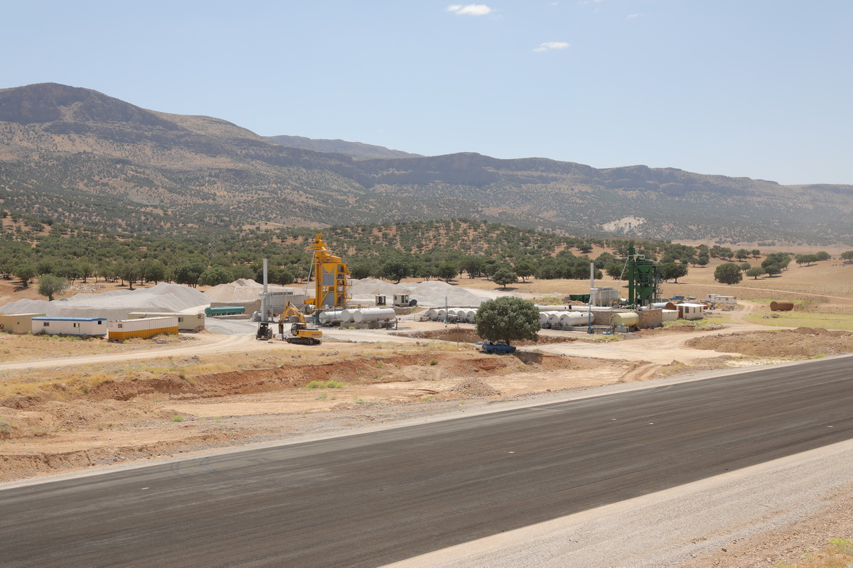
آزادراه اصفهان-شیراز
آگوست 30, 2018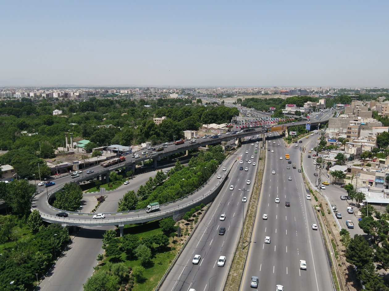
گذرگاه غير هم سطح كلاك، کرج
فوریه 25, 2020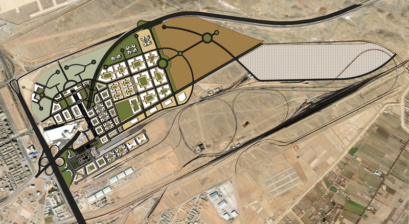
شرکت پلرود
طرح جامع و راهبردی ایستگاه راه آهن اصفهان بر اساس الگوی TOD
طرح جامع و راهبردی ایستگاه راه آهن اصفهان
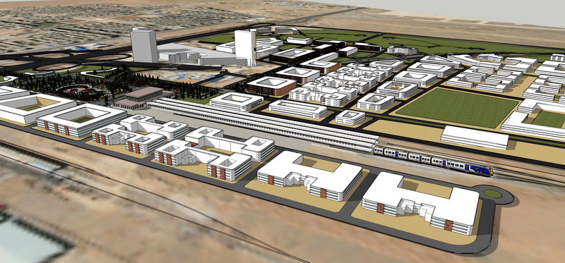
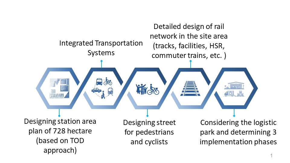
طرح جامع و راهبردی ایستگاه اصفهان بر اساس الگوی توسعه مبتنی بر حمل و نقل همگانی در سال 1396 به مهندسین مشاور پل رود ابلاغ گردید. مطالعات طرح جامع و راهبردی ایستگاه راهآهن اصفهان، به دنبال ارائه طرح توسعه ایستگاه راه¬آهن اصفهان به¬عنوان یکی از نقاط مهم دارای پتانسیل توسعه، برای افق سال 1420 بوده است. هدف اصلی، تغییر رویکرد نسبت به ایستگاه بوده است: به جای آنکه ایستگاه صرفاً نقطهی شروع و پایان سفر باشد، به مکانی برای مکث، تفریح و استراحت بدل گردد. مطالعات طرح جامع و راهبردی ایستگاه راه آهن اصفهان طی سالهای 1396- 1398 انجام گردیده است. کارفرمای این طرح، شرکت راه آهن جمهوری اسلامی ایران بوده است.
مساحت محدوده:
728 هکتار
تقاضای افق 1420:
36 میلیون تن
تقاضای مسافری افق 1420:
2.1 میلیون نفر مسافر دوربرد +
24.2 میلیون نفر مسافر حومه ای
توسعه مبتنی بر حمل و نقل همگانی در ایستگاه راه آهن اصفهان
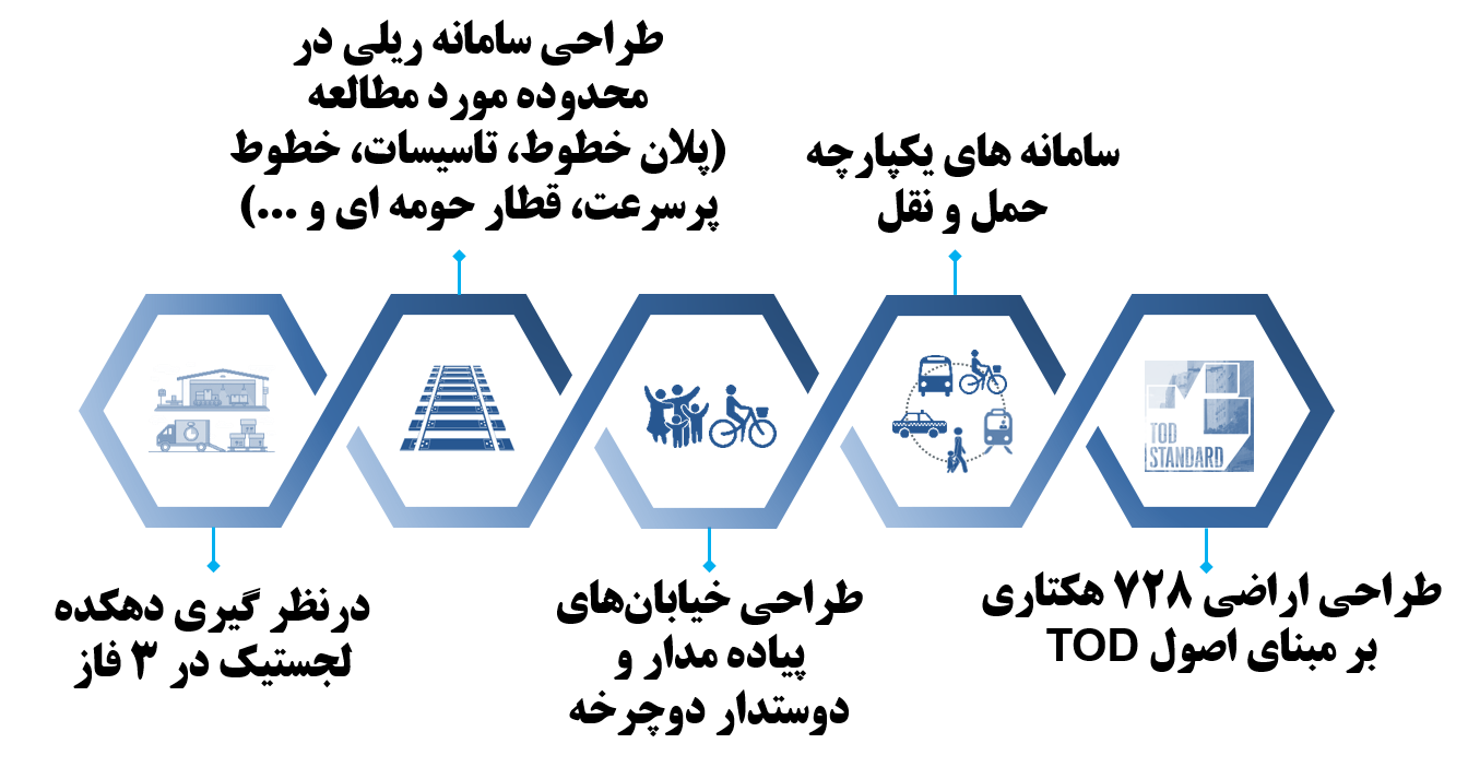
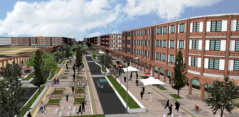
طرح جامع و راهبردی ایستگاه راه آهن اصفهان بر اساس الگوی توسعه مبتنی بر حمل و نقل همگانی (TOD) به دنبال تبدیل ایستگاه راه آهن به مکانی جذاب است. این مطالعه در مقیاس پهنه ایستگاهی، صورت گرفته است و اصول هشتگانه TOD در طراحی ها لحاظ گردیده است. این اصول هشتگانه عبارتند از:
1. توسعه محله های دوستدار پیاده
2. اولویت دادن به شبکه حملونقل غیرموتوری
3. توسعه متراکم
4. توسعه فشرده
5. برنامهريزي برای کاربریهای مختلط
6. توسعه شهری در مجاورت ایستگاههای حملونقل همگانی باکیفیت بالا
7. ارتقا اتصالپذیری با ارتقا تنوع مسیرهای دسترسی
8. تغییر نگرش و افزایش تحرک پذیری
شرايط طبيعي و اقليمي منطقه:
طراحی جزئیات شبکه ریلی داخل اراضی به انضمام خطوط و ایستگاه قطار حومه ای و قطار پرسرعت : طول خطوط وضع موجود 28 کیلومتر طول خطوط در طرح ریلی پیشنهادی حدود 36 کیلومتر
همکاری 26 دپارتمان مختلف در طراحی مجموعه: حمل و نقل ریلی، ترافیک، شهرسازی و معماری، فرهنگی، اقتصادی، اجتماعی، زیستمحیطی و تاسیسات برقی، مکانیکی، زمینشناسی و ...
محور «چهار باغ نو» بر مبنای الگوی پیاده محور و با درنظر گیری مسیرهای دوچرخه
polRood Company
The comprehensive and strategic plan of Isfahan
The comprehensive and strategic plan of Isfahan
The comprehensive and strategic plan of Isfahan station based on public transportation development Were assigned to Polrood consulting engineers in 2017. Comprehensive and strategic plan of Isfahan Railway Station were performed to present the development plan of Isfahan Railway Station for the time horizon of 2041. The main goal was to change the approach to the station: instead of just being the start and end point of the trip, it became a place for rest and enjoyment. These studies have been done for three years. The employer of this project was the Railway Company of the Islamic Republic of Iran.
Area:
728 hectares
Horizon demand 1420:
36 million tons
Horizon 1420 passenger demand:
2.1 million long-distance passengers +
24.2 million suburban passengers
Development based on public transportation in Isfahan railway station
The comprehensive and strategic plan of Isfahan railway station, based on public transportation development(TOD) model, seeks to turn the railway station into an attractive place. This study has been done at the station area scale and the eight principles of TOD have been considered in the designs. These eight principles are:
1. Development of pedestrian-friendly neighborhoods
2. Prioritize the non-motorized transportation network
3. Dense development
4. Intensive development
5. Planning for mixed land uses
6. Urban development in the vicinity of high quality public transport stations
7. Improve connectivity by improving the variety of access routes
8. Change attitude and increase mobility
Natural and climatic conditions of the region:
Detail design of inner network including lines, suburban train stations and high-speed trains: Length of existing status lines is 28 km and Length of lines in the proposed railway plan is about 36 km.
26 different departments cooperated in the design of the complex: rail transport, traffic, urban planning and architecture, cultural, economic, social, environmental and electrical, mechanical, geological and ...
The "Chahar Bagh No" axis is based on the pedestrian axis model and considering bicycle paths